Evaluation of Satellite Data for Oyster Aquaculture Modeling
April 25, 2025 09:33 AM
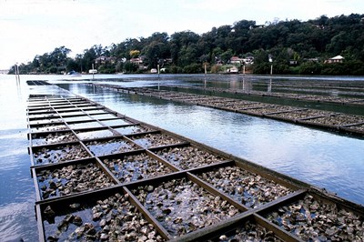
Oyster Farming
© Wikipedia Creative Commons from:https://commons.wikimedia.org/wiki/File:CSIRO_ScienceImage_2901_Oyster_Farming.jpg
Ron Vogel, Senior Faculty Specialist, UMD/CISESS/ESSIC
Many waterbodies in the U.S. and elsewhere experience eutrophication primarily caused by nutrient pollution arising from human-related activities like nitrogen and phosphorus discharges. Chesapeake Bay is one such waterbody that is highly polluted this way. Over the past couple of decades, researchers have investigated bivalve shellfish aquaculture as a way of improving water quality, given that shellfish, such as oysters, filter out these kinds of chemicals from the water. Models exist that can predict oyster harvest and the amount of nutrients that can be removed from the water, using chlorophyll-a concentration and other water quality parameters as input. However, at least a year’s worth of such input data is needed for simulations, and in-situ monitoring of water quality at oyster farms can be costly, estimated at ∼$7,700 per sampling stationper year. In a paper published in the Journal of Shellfish Research, CISESS Scientist Ron Vogel and colleagues assess whether satellite data products and water quality data collected routinely by the Maryland Department of Natural Resources (MDDNR) can replace on-site measurements taken at oyster farms as input to an oyster harvest model. Two oyster-farm study sites in the Maryland part of the Chesapeake Bay were chosen: Chester River and North Tangier Sound. Vogel reports that there wereno significantdifferences in on-farm and MDDNR chlorophyll-aconcentrations nor between on-farm and satellite chlorophyll-aconcentrations at either of the oyster-farmstudy sites. These results suggest that both MDDNR and satellite chlorophyll-adata can be substituted for on-farm project specific data, saving time and money.
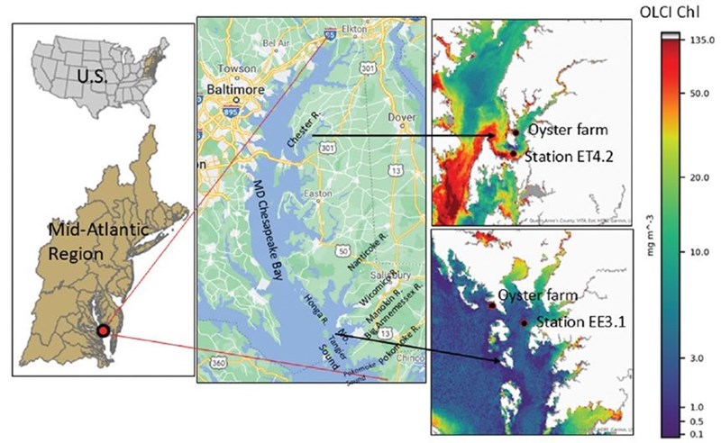
Figure: Locations of the oyster-farm study sites and Maryland Department of Natural Resources stations ~8 km away from the study sites. Chlorophyll concentration imagery from the Ocean Land Colour Instrument are shown on the right.
Citation:Bricker, Suzanne, Varis Ransibrahmanakul, Katherine Okada, Eric Davenport, Renee Karrh, Ronald L. Vogel, Travis Briggs, and Michelle C. Tomlinson, 2025: Evaluating satellite data products and state monitoring data as substitutes for on-farm data for oyster aquaculture modeling. J. Shellfish Res., 44(1), 105-123, https://doi.org/10.2983/035.044.0110.
From: Maureen Cribb, CISESS Report to NOAA for 25 April 2025.
« Back