GOES-16 ABI Land Surface Temperature
August 16, 2017 05:28 AM
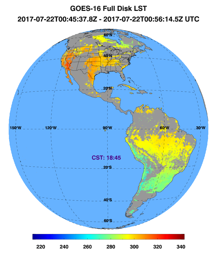
Figure 1: The GOES-16 Full Disk LST Product
© NOAA/STAR/SMCD/EMB
by Peng Yu
Land surface Temperature (LST) is one of the key parameters in the weather and climate system controlling surface heat and water exchange between the land and the atmosphere.Knowledge of the LST provides information on the temporal and spatial variations of the surface equilibrium state and is of fundamental importance to many aspects of the geosciences, e.g., the net radiation budget at the Earth surface and to monitoring the state of crops and vegetation, as well as an important indicator of both the greenhouse effect and the energy flux between the atmosphere and the land.
The GOES-R satellite, which was named as GOES-16 after its launch in November 2016, is the follow-on to the current NOAA Geostationary Orbital Environmental Satellite (GOES) system. The Advanced Baseline Imager (ABI) onboard GOES-R is able to provide valuable data for a wide range of qualitative and quantitative weather, oceanographic, climate, and environmental applications. Compared to its predecessors, ABI offers more spectral bands, higher spatial resolution, and faster imaging rate. It enables a more detailed monitoring of our planet and provides significant advantages in retrieving many high level products including the LST (Data are available at https://www.class.ngdc.noaa.gov).
As a part of the GOES-R LST Algorithm Working Group (AWG), CICS-UMD scientists have made important contributions to the development, improvement, calibration, and validation of the LST products. The initial inspection and evaluation of the GOES-16 LST EDR has been carried out and as a result it successfully reached the Beta release maturity on May 24th, 2017. Comprehensive validation activities are ongoing towards the product provisional and validated maturity levels.
« Back