A New Eye to Monitor Global Aerosol Activities
July 31, 2013 09:57 AM
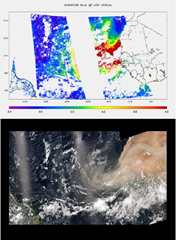
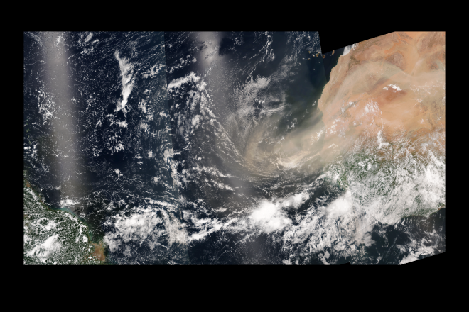
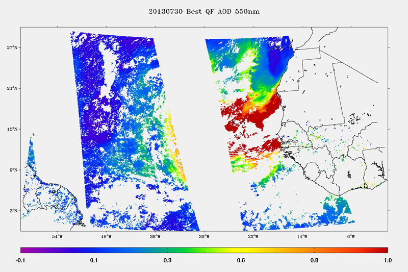
These VIIRS images show the latest African dust storm traveling across tropical Atlantic (RGB on the bottom and the corresponding VIIRS best quality Aerosol Optical Depth on the top).
© Jingfeng Huang, ESSIC/CICS/UMD, STAR/NESDIS/NOAA
By Jingfeng Huang, ESSIC/CICS/UMD, STAR/NESDIS/NOAA
Atmospheric particles, also called aerosols, are strongly related to air pollution, human health, weather forecast, aclimate change, and even military deployment. Continuing the Moderate resolution Imaging Spectroradiometer (MODIS) heritage, the new Suomi National Polar-orbiting Partnership (NPP) Visible Infrared Imaging Radiometer Suite (VIIRS) provides both the operational and scientific data user communities new enhanced capability in monitoring global aerosol activities.
The Suomi National Polar-orbiting Partnership (NPP) Visible Infrared Imaging Radiometer Suite (VIIRS) instrument began collecting data shortly after its launch in October 2011 and its aerosol products have been available at a beta maturity state beginning in May 2012 and reached provisional status since Jan 23, 2013.
The NPP/VIIRS operational aerosol products include aerosol optical depth (AOD) at 11 wavelengths, aerosol size parameter (Ångström Exponent, AE) and type-related information (Suspended Matter). VIIRS aerosol retrieval is performed at moderate resolution pixel level (~0.75 to 1.6 km from nadir to edge), and aggregates to ~6 to 12.8 km resolution for the Environment Data Record (EDR) products.
To use this newly released data in numerical weather prediction and to build it into long-term aerosol climate record requires a thorough characterization of the aerosol products, particularly in comparison to the preceding established well-characterized aerosol products. The CICS-MD Scientists, Drs. Jingfeng Huang and Ho-Chun Huang, are working closely with the NOAA NESDIS VIIRS Calibration / Validation Team, to keep improving the VIIRS aerosol products. The Cal/Val results indicated that VIIRS achieves comparable performance to MODIS in terms of observing spatial and temporal variability of global aerosols. The NPP/VIIRS aerosol products will prove a valuable asset to the data user community in meeting the operational and research needs of air quality, weather forecasting, and climate impact studies.
The following VIIRS images showed the latest African dust storm traveling across tropical Atlantic (RGB on the top and the corresponding VIIRS best quality Aerosol Optical Depth on the bottom):
A corresponding NOAA/NCEP NGAC aerosol model captures the same event and forecasts the path and intensity of the dust storm: http://www.nnvl.noaa.gov/MediaDetail2.php?MediaID=1395&MediaTypeID=3&ResourceID=104786
« Back