cicsmd


view all

Featured News

Friday, April 3, 2026

Wildfires Disrupt the Atmospheric Nitrogen Cycle in Ecosystems

CISESS Consortium Scientists Patrick Campbell, Daniel Tong, Youhua Tang (GMU) and coauthors discuss multi-decadal fire activity and how it influences changes in reactive nitrogen emissions across the contiguous United States in their paper recently published in the journal Communications Earth & Environment.
Monday, March 30, 2026

New Chemistry for the Unified Forecasting System

CISESS Scientists Kai Yang (AOSC), Zachary Moon and colleagues have created a generalized global configuration to NOAA’s official Unified Forecasting System (UFS) to better simulate the full tropospheric and stratospheric chemistry needed for global air quality applications. The new Configurable ATmospheric Chemistry (CATChem) library and modeling component is described in their paper published in the Journal of Advances in Modeling Earth Systems.

News

 
Category:
 
Results: 147 Articles found.
Jingfeng_Article_2
S-NPP VIIRS Aerosol Products
Jul 31, 2013 09:57 AM

A New Eye to Monitor Global Aerosol Activities

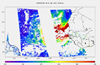
The new Suomi National Polar-orbiting Partnership (NPP) Visible Infrared Imaging Radiometer Suite (VIIRS) provides both the operational and scientific data user communities new enhanced capability in monitoring global aerosol activities. The NPP/VIIRS aerosol products will prove a valuable asset to the data user community in meeting the operational and research needs of air quality, weather forecasting, and climate impact studies. It recently tracked a large cohesive African dust cloud.

 
Moore_Tornado
Hail Dip
Jul 05, 2013 10:23 AM

Moore, Oklahoma F-5 Tornado Viewed by Satellite

GCOM passed over the Oklahoma region approximately 15 minutes prior to the touchdown of the EF-5 tornado that ravaged central OK on May 20, 2013. Rain retrieval rates, brightness temperatures, and polarization differences were analyzed.

 
Index
Evaporative Stress Index
May 23, 2013 05:05 AM

CICS Researchers Develop Tools for Monitoring Drought from Space

Researchers at the Cooperative Institute for Climate and Satellites led by Christopher Hain, along with colleagues from NOAA and the USDA Agricultural Research Service have developed a unique satellite based methodology for mapping drought over the United States.


Results: 147 Articles found.
close (X)